WSDOT SR 16 – Tacoma Narrows Bridge to SR 3 Congestion Study
Read the Original Study Report on the WSDOT Website
WSDOT has completed the SR 16 Tacoma Narrows Bridge to SR 3 Congestion Study and the report is now available for viewing.
Study Report
Executive Summary (pdf 2.3 mb)
Study Report (pdf 5 mb)
Study Purpose
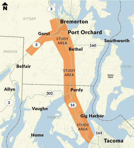
WSDOT examined traffic congestion along State Route 16 between the Tacoma Narrows Bridge and Gorst, as well as portions of SR 3 and SR 304 in Pierce and Kitsap counties.
The End Result
The study report concluded with recommended near-, mid- and long-term strategies. Highlights of these recommendations include:
- Operational, channelization, and signal/ITS improvements at key local and state locations
- Capacity improvements at key local and state facilities by widening, roundabout, or signal installations
- Improving pedestrian and bicycle facilities by the extension of the Cushman Trail, new facilities between Bremerton and Port Orchard, and additions or enhancements to bike lanes along the corridor
- SR 3 and SR 16 capacity improvements by peak-use shoulder lanes and widening
- SR 304/Naval Base Kitsap-Bremerton area improvements at Farragut Avenue and Charleston Beach Road
- SR 3/SR 16 interchange access control, intersection improvements, and grade separation
- Tremont Street and Sedgwick Road interchange capacity improvements at key intersections
- SR 302 and Borgen Boulevard Interchange capacity, operational, and queue storage improvements
- Olympic Drive, Wollochet Drive, and Hunt Street crossing operational and capacity improvements
Corridor-wide recommendations include:
- Travel Demand Management strategies
- Increased coordination of incident response
- Plans for addressing resiliency and climate change
- Additional park and ride capacity and coordination between agencies
Funding
The SR 16, Tacoma Narrows Bridge to SR 3, Congestion Study was funded by Connecting Washington, a funding package passed by the Washington Legislature in 2015.
Timeline
November – December 2016: Define project vision and goals
January – April 2017: Understand existing conditions and corridor needs, public opinion survey
May – September 2017: Develop and model strategies to improve travel
October – December 2017: Gather public input on strategies, evaluate strategies
January – May 2018: Develop final recommendations and share final recommendations with members of the public
June – December 2018: Community engagement and review of recommended strategies, write study report
January 2019: Finalize and publish study report
Contact
Dennis Engel, Multimodal Planning Manager
360-357-2651

